From November 16, 2004, I stayed on in Lewis.
Further entries are in the main Northern Trip diary.
Continuation
Cearsiadar - 16/11/04
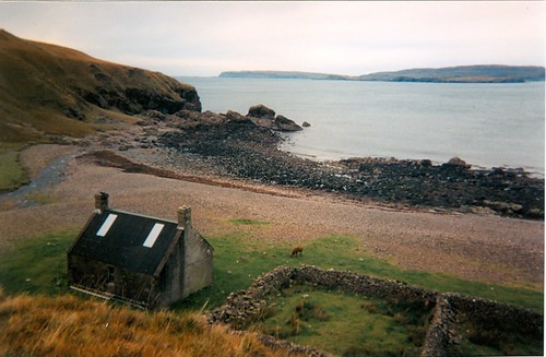
Woke up to a guy shouting abuse in his sleep, and someone else shooshing him. The two American ladies collected their car at 8.30, declining my overzealous offer of being their guide. I set off downtown sunny Stornoway / Steornabhagh. First to the library for a full hour's worth of Internet use. Had about 40 emails waiting. Then to various bookshops, one of which stocked Soil and Soul, a landmark work by Alistair McIntosh. He is not well known outside this region, but is a staunch campaigner for community ownership. He supported the community buy-out of the Isle of Eigg in 1996/7, and managed to stop the development of the Lingerabay superquarry. This would have seen the demolition of an entire mountain for the sake of acquiring aggregates for the building of houses and roads in the UK and beyond. I also unearthed a compilation CD by Capercaillie, my favourite folk / fusion group from these parts. Went to a gig by them, as some know, back in January. Didn't walk back to my digs, no danced home. Just as well it was 11.30pm. It's no use having a CD without the means of listening to it, so I also acquired a portable CD-player. Then there was the matter of my 3 disposable cameras, all used up, which needed to be developed and printed. I would have preferred the images to be on CD-ROM, but that means you have to wait for 3-4 days, and I don't work that far in advance with regards to planning. One shop could develop & print in 2 hours, but not the CD-ROM. Sod it, I went for the prints. The most important one is attached to this journal entry. Then I went on a walk down the harbourfront as far as the old powerstation. Sat down on the seawall and was duly joined by a nice tortoiseshell cat, a neutered tom. He rubbed against me as I sat nibbling my sandwiches, wanted to be scratched on the head and a general fuss. After that, he went down the steps to the shore, only to bolt back up them a minute later and disappear into the estate behind me. Strange animal. My bus left town at 2.20pm, heading down the road towards Tarbert. I got off at Balallan (Baile Ailean), to join the little bus into South Lochs. Recognized the driver from years ago. A ten minute journey brought me to Cearsiadar - just say KerSHAder. The hostel is part of a community building also encompassing a shop and a cafe. The volunteers in the shop also run the hostel, which is simple but comfortable. Oh, the only uncomfortable thing about the hostel is the chairs. Eugh. After a longish chat, I went inside. A run-down of things not to do:
- don't close the kitchendoor, the handle is broken
- don't switch off the light in the stairwell
- don't use the shower upstairs
- don't use the third bedroom
- don't leave the central heating on if you don't need it
Ah, it's all a laugh, really. There are only two people in the hostel now, a guy called Joe and myself. He is going round the island looking for a job and a place to live. Exchanged some stories over dinner. Joe cooked onions and potatoes with mince and shandy to drink. The television provided some entertainment, but that was about it for the night.
Through Berneray to Stornoway - 15/11/04
At 8.10 this morning, the basket-ball team left for their match at Lionacleit, Benbecula. I had barely time to catch my breath, when a new group of people marched in. Seven folk, about to set off by sea-kayak to the Monach Islands. Heard that before. I left for Lochmaddy at 10 o'clock, and headed north by postbus to Berneray one hour later. Spent about half an hour rattling the keyboard in Tigh na Chearsabhagh, the sound of which drove one person mad. Not me! Some of you may be aware I'm a fast typist (70 wpm), and it is quite a noise when I'm in my stride. The postbus lady very kindly dropped me off at the road-end in Berneray, where you can go down to the Burnside B&B (prop. Mrs McKillop) where I stayed in 1995. Memories of being asked to join in the fun at the Berneray week, in which I was nearly drowned in the Knockout. And Mrs McKillop horrified that it was her new guest, all bedraggled, asking for a cup of soup afterwards. Now there was nothing in that field. Only a selection of rams. It's that time of the year when the rams are put to the ewes. Yep, necessary, else you don't get those cute little lambs in spring. The rams have a block of waxy dye bound to their chest. When the ram does his job, the dye rubs on to the ewe's shoulder, and thus the farmer knows that she has been served. The sheep on Berneray do not have horns, they have large black floppy ears, which gives them a funny look. It was quite chilly out there in the field, so I quickly hobbled back to the ferry terminal and waited for the MV Loch Portain to turn up at 1.20 to take me to Leverburgh. There was a fair queue of traffic waiting to go, including a fuel tanker. This led to a complete ban on smoking on board. You are normally allowed to smoke on the outer deck. The ferry made a tortuous and at times slow journey across the Sound of Harris, circumventing reefs and other underwater dangers. It took an hour, arriving at Leverburgh at 2.20. Had to wait for 40 minutes for the bus to depart north to Stornoway. Forgot to mention that at 1pm the sun came out, and it made the crossing quite beautiful. When the bus finally departed it was a picture postcard journey, with the beaches and views of West Harris in a hazy late autumn light. The sands were yellow, not white, due to the light. Arrived in Tarbert at 3.40, left there a few minutes later. The trip through the mountains was quite familiar, from my earlier journey in August of this year. After Balallan darkness began tofall. Arrived in Stornoway at 4.50. There were only a few other people on the bus. The route can be very busy in summer, with the driver giving a running commentary on the scenery. Now he greets every local customer by name. Having done the shopping, I headed for my hostel for the night. Fairhaven, on Francis Street. Easily found, but not exactly a model for organisation. Had to wait for 2 hours for the proprietors to turn up to take payment. Went for a very good meal at the Crown Hotel in the meantime. There were two dorms in the place, one being taken up by Polish workers in the local fish factory. The kitchen was a pokey little place, with dry rot up the walls. Yuk. The kettle was filled with brown water, although the tapwater was clear. Yuk again. Went to bed early, Stornoway is not noteworthy for its nightlife. Oh, gave two USA lassies some advice re. a trip around the island by car
Trumisgarry - Remembrance Sunday 14/11/04
Remembrance Sunday dawned wet and windy. A force 5-7 wind, with gusts up to 8 was blowing drizzle across the island. I would have liked to have gone to a Remembrance Sunday commemoration, but it was being held at Clachan, 8 miles away. I decided to walk down the road towards Berneray, starting at 10.15. Oh, forget to tell there were two house movers in the hostel last night, and a strange character dossing down on the couch. Along the road to Berneray, I noticed an otter lolloping through a saltmarsh near Trumisgarry. Went down the road to some cemeteries and the beach. Walked down the beach, with the wind buffeting me. Sat down amidst the sanddunes and took it easy. For more than an hour. Then, I retraced my steps past the cows and the cemeteries. A sheepdog began to follow me, jumping up at me, quite friendly. He even managed the cattle-grids, but left me at the road junction. Then a black kitten dashed across the road and hid amongst the long grass. I found it and tickled it. It finally shot out again after a minute's play. 100 yards further on, a dead mouse lay in the road. You don't see this sort of thing from a car. Trudged the remaining 7 miles back to Lochmaddy in fitful rain and failing light. On return, at 4.15, I ran into Mairi who told me that a class of schoolkids would be in the hostel tonight. And they duly materialized. No trouble at all, they were due to play an early game of basketball at Lionacleit in Benbecula, to return to the mainland on the ferry at lunchtime. Went to bed at 11.
Balranald RSPB Reserve - 13/11/04
Back in Taigh Chearsabhag in Lochmaddy to update the journal. On Saturday, I took the postbus out to Balranald, located on the west side of North Uist. This is an area of working crofts, but world famous as a nature reserve. The RSPB (Royal Society for the Protection of Birds) manage it. The little postbus rattled out at 11 am, after I had done my weekend shop. The shop here is quite dear, £6 for just a few groceries. On driving round the northern side of the island, the wide sandy beaches spring into view after passing the Berneray road-end. Once you turn the northwestern corner, beyond Sollas, St Kilda hoves into view. This group of islands, with cliffs of over 1,000 ft high, was abandoned in 1930. The inhabitants at the time asked to be taken of because of disease and starvation. Starvation contributed to by neglect by government, allegedly. The isles lie about 45 miles away, but stand out like a set of snaggled teeth on the western horizon. Another notable sight is Scolpaig Tower, set in the middle of a lochan, with a causeway leading up to it. Arrived at Balranald at midday. It was quite empty, but the day is bright. A nature trail leads up to the coastline. Not many birds about, just some swans and some starlings. Sat on the rocky foreshore with my back to the strong northerly wind and my face in the warm sun. Bliss. Temperature 12C. Spent an hour of lounging about, watching showers pass by into Benbecula and observing the tall lighthouse on the Monach Isles. The latter was actually found abandoned in 1900. When the light was never extinguished during the daytime, a boat was sent across to investigate. A table was set with plates and food, and lights were still burning. The three men tending the tower were nowhere to be found, and have never been recovered. It is assumed that they had to go out and were swept away by a huge sea. Walked back to the Visitor Centre and the road end to wait for the postbus back. Although this departed at 2.30, it would not return to Lochmaddy much before 4pm. The reason being that it had to go round the houses to deliver mail. The usual spectacle developed of postie (a lady) being splattered with mud by overfriendly dogs, gates having to be opened and mail left just inside the front door. One door was locked, so the mail was left inside a Volkswagen Beatle on the drive. Like you do. We also called at the home of the island's proprietors, the Boulmers (?). And at a farm, near Scolpaig Tower, where a 95-year gent still lived on his own, albeit with home help. Postie was only inside for 2 minutes, a record fast visit. Being the local gossip, he wanted to know all the news. One other gentleman, it transpired, had recently passed away, and the community was saddened by their loss. Returned to Lochmaddy at 4, and spent the rest of the evening in the UOC.
Eriskay - 12/11/04
After breakfast, I decided to dump the gloom and go and make something of the day. Jumped on a bus, which was the first of three to take me down to Eriskay, 3 hours away. First to Clachan, then a McDonalds bus to Lochboisdale, and finally a vehicle to Eriskay. After Clachan there are a number of causeways to take you across to Grimsay and Benbecula (Beinn na Faoghla) and finally South Uist. On South Uist, there is the tracking station for the missiles and two high hills (2000 ft plus) called Beinn Mhor and Hekla. You can't miss them. Lochboisdale is an unsightly little place, where the Oban ferry calls. Eriskay is very nice, got there at 12.45. Linked to South Uist by causeway for a few years, the islanders love it. The weather was awful though. Galeforce northwesterly, frequent showers and 9C. The windchill made it feel more like minus 1C. Struggled to Haunn, where the old ferry terminal was, blocked by a huge sandbar. Back to Balla (Village), where I had a cup of soup in the pub Am Politician, named after the famous whisky boat which was wrecked off Eriskay in 1941, leaving it for the islanders to help themselves to the booze. Read "Whisky Galore" by Compton McKenzie. Incidentally, the word galore is of Gaelic origin, gu leoir meaning plenty. Had a walk down towards the Barra ferry terminal, along a stretch of very pretty beach. Pity about the gale though. Ferry to Ard Mhor had been cancelled for the day, as had many other ferries as it turned out later. Hobbled back through a very painful hailshower to the shop, then jumped on the bus. This took me all the way up to Clachan, but with some bloody long stops along the way. One gentleman joined me who would have gone on the Oban ferry, but this had been cancelled. He would go to Lochmaddy, but was worried about where to stay. I showed him to the hostel, once we got there at 6.10. He was quite grateful. We stopped also at the school at Linnacleit on Benbecula, where we could have a cuppa. Next to the swimming pool. Felt like a dip!
Berneray and Lochmaddy - 11/11/04
After a huge breakfast at 8.30 I went to Taigh Chearsabhagh, the local museum and arts centre. Had a cuppa and dabbled on the internet there, but didn't have time to update journal. Jumped on the 11.05 postbus to Berneray, with the half-formed idea of moving into the hostel there. Not a good idea, as I found out on arrival there. The hostel was quite basic and lacked a toilet. Otherwise a nice, rustic little place. But I'm not prepared to bare my all to the elements on the rocks of the foreshore thank you. Berneray holds some happy memories for me from my 1995 visit, when I was dragged into the "It's a Knockout" competition, which nearly drowned me. No-one about this time, it's cold and wet today. Went for a walk towards the northern end of the island, but turned back in order not to miss the 3pm bus back. Sheltered in the hostel until bus-time, chatted to an old farmer along the way by the way. Left a pound for day-use and jumped on the Grenitote bus to Sollas. The driver, a pleasant lady called Catherine, also did the schoolrun. Five primary school kids jumped on board at the school, and were dropped off at various points. One in Lochmaddy. A man was offered a lift, with the question: "to the shop or to your mum?". He needed the shop. At Sollas was transferred to another bus which dropped me at the Outdoor Centre. Now it was occupied - by the proprietors .They told me the door was never locked. Sure. Anyway, got a roof over my head. The only thing is the lack of adequate heating. The computer doesn't give access to secure sites (like AOL), so I'm very restricted. Some readers may have had email from me on a Yahoo! username; feel free to reply on that. Not terribly impressed, but you can't have it all. Am alone tonight, which suits me fine. Foul mood today.
Location, location, location - 10/11/04
Woke up to a bright and sunny morning, a complete contrast to yesterday's wintery situation. Today I'm relocating - to Lochmaddy, North Uist, Western Isles. Walked to Fort William at 9 o'clock, leaving Glen Nevis for the final time on this visit. The bus to Uig left at 10.15 and took me on a wonder tour through the wild west of Scotland. It was fantastic. The sun was out and put everything in a beautiful autumn hue. The Great Glen, Loch Garry, from the viewpoint on the A87 beyond Invergarry, Cluanie, Glen Shiel and Skye. Sgurr nan Gillean cast a shadow at 1pm which almost reached the road. The sun was that low. Reached Uig at 1.45, and had to wait for the Lochmaddy ferry for about half an hour. Not many were going that afternoon. At 2.15 footpassengers were transferred to the Hebrides in a minibus. Once the ferry had docked, the walkway was hoisted up and we could go on board. The crossing was totally unremarkable, hardly any swell. Arrived into Lochmaddy at dusk at 4.40. Walked to the Uist Outdoor Centre, where things went pearshape. The door was locked, the building was in darkness and nobody about. Rather disgruntled I withdrew to the nearest phonebooth and rang the proprietors, or tried to. Neither phonenumber was answered .Oh. So I relocated to the Lochmaddy Hotel for the night, and determined to sort this stupid problem out the next day. Waitress at the hotel snatched plate from under me nose before I had finished it, and you cannot remonstrate with a full mouth, can you now. Bad end to the day.
Winter in the hills - 09/11/04
Today was allocated to serious hillwalking. At 8.20, I left the hostel for an attempt to climb Stob Ban, a 999m high mountain to the south of Glen Nevis. The weather forecast looked rather dire; showers, as snow above 2,000 ft. Not to be daunted, I ambled the 40 mins down the Glen Nevis road to Mamore Grazings by the Lower Falls, where I turned onto the path leading towards Stob Ban. At 9.05, I started the climb, and got the first of many showers. The path was very wet, boggy and waterlogged. Had fun and games traversing some of the streams, and nearly ended up in one of them. Wobbly boulder. Just after 10 o'clock, there was another shower, and I looked around what was going on. There was a funny noise on my hood, it didn't sound like a raindrop. No. It was snowflakes. They settled on my mapcase, the rucksack, everything. Temperature had dropped to 5C. Staggered at the presence of the snow, I nonetheless carried on. The fact that it was still above freezing meant that the snow would not settle. Wound my way up the hillside and got seriously high. At 11 o'clock, just under two hours after starting the climb proper, I reached the pass at altitude 750 m (2,500 ft). Fantastic views. Stob Ban reared up high to my right, only to immediately disappear into a snow-shower. Another Munro loomed to the left. And the paths did NOT conform to their location on the map. To the south I saw Loch Leven and the Lairig from Kinlochleven to Lundavra. Absolutely breathtaking. Sat out the snowshower, which I did NOT enjoy. It's very cold now (+3C), particularly in the wind. Once the shower had passed, I started the climb towards the peak, which initially was a steep but simple and straightforward ascent. At altitude 850m (2850 ft) things got a little more complicated. The grass disappeared and the path went into a hillside covered by boulders, white stone as it happened. I got an increasing feeling of exposure, due to the steep slopes falling away on either side. Having taken stock of my position, the time (11.30) I decided to carry on into the scrambly bits. However, by this time, wisps of cloud began to rise from the hillside to the south. Those wisps blew up in size and obliterated the view. That was the point where I thought to myself: "Not happy with that". I still had about 100m to climb, in (for me) difficult terrain. If one of those clouds came over and obliterated the view again, it could take a long time to clear. I'd seen the peak wreathed in mist for a considerable period of time. So I took the decision at 11.40 to retrace my steps. I went back to the cairn at the crossing of paths where I'd come up from Glen Nevis, then proceeded onwards to the little lochan a few hundred yards east. An inviting path wound its way up a hillside to the next Munro, 1,001m high, but then the third snowshower commenced. It meant business. Temperature dropped to +2 at my location (800m) and the snow settled just above my height. Lunch was freezing cold on the edge of the lochan, I've never felt so cold on a walk. Not enjoyable at all. IT WAS SO COLD. I went down towards Glen Nevis again, and found the temperature rising as I went down. Was overtaken by a very fast walker at 2pm, and two not so fast ones at 2.30. Got down to the road at 3pm, after a very wearying slog downhill. Reported my safe return at 3.50 in the hostel, then went into town for the shopping. Returned to a virtually empty Glen Nevis YH at 5.45. Met a lady from Taiwan who was quite rude about the staff in the Tourist Office in Fort William. She wanted to stay on a working farm. Yep. In November, oh please, get real. They'll be out with their sheepdogs, sure! Small wonder the TIC couldn't help. I made a few suggestions, but to no avail, I think. A farm at Invergarry, she was looking at (30 miles from here) or Spean Bridge (12 miles). And she wanted to know at what time breakfast was served. Only to groups. Get some cereals from reception. Sorry, I'm not normally that rude about fellow hostellers, but this lady just did not realize she had come at the wrong time of year.
Check the below link for pictures of Glen Nevis
Cow Hill - 08/11/04
This morning, my erstwhile companion of Orkney days (September) took herself off and away to Glencoe. To my surprise. Even more so when she told me that initially it had been her intention to climb the Ben. OK, go with the wind, that's the spirit of the true traveller. I wished her well.
I whisked myself off to downtown Fort William for the Monday shopping. Found some very useful mending tape for a tear in my waterproofs. Should teach me to sit on sharp rocks. It's the second that's happened. At around midday, I tootled off to Cow Hill, because the weather today is absolutely brilliant. In comparison to previous days, that is. The sun is out and it is not too bad. Just some wisps of cloud around the highest slopes of Ben Nevis and some fishhook cirrus at the 30,000 ft mark. As time wore on, the wisps of cloud at 4,000 ft sank to about 3,000 and thickened to a typical cumulostratus layer with holes. On arrival on Cow Hill, 287 m, I had a fantastic view all around. Saw far up Glen Albyn (the Great Glen). It presented an image that I always associate with the Misty Mountains in Tolkien's books. Row upon row of valley marching away in the far distance. Could clearly see Corpach and Caol, Inverlochy and a bird's eye view of Fort William. Cow Hill stands literally on the doorstep of the town. To the south, Loch Linnhe stretched away; Loch Eil was partially obscured by the Ardgour hills on the other side of the water. Magnificent. Slowly trudged down the hill and turned left to go down into Glen Nevis. Took my bonny time doing it, although the descent into the Glen was viciously steep. Mind your step! Returned to the hostel as night fell, having made some detours up the forestry roads. Hostel is very quiet as yet. Over the weekend it was quite full. On Saturday evening, people had to be turned away. To be fair, several rooms are out of use because the bunkbeds need to be replaced.
Glen Nevis - 07/11/04
Walked up to an Iron Age fort off the West Highland Way. It is located on top of a hill 350m high, and a commanding position. Then worked my way down through the forest below, which was well-nigh impossible. Walked along the forestry road to the Lower Falls, which were in spectacular spate. A walk along the south bank of the River Nevis was once again a soppy affair. By 4pm, I had reached the end of the Glen Nevis road. Bats and long-tailed tits were flying about in the gathering dusk. I left at 4.20 for the hostel. Thanks to some kind-hearted folk I reached it at 5.20, whereas without the lift it would have been nearer 6pm. The weather: low cloud over the hills, temperature 13-14C and little wind. There was some drizzle.
Cow Hill and Glen Finnan - 06/11/04
This morning dawned a little grey, with clouds down very low. I decided to go to Fort William for a bit of shopping, but not to take the usual route down Glen Nevis. Instead, I took a route I discovered yesterday, being the West Highland Way northbound, and at the junction of paths 1 miles west of the Ben Nevis Visitor Centre turn up the hill towards Cow Hill. This path is very steep, and it is half an hour of stiff climbing. Almost as steep as the path to Ben Nevis, but not as long. On reaching the top, the transmitter masts on the top of Cow Hill (287m) were shrouded in clouds. Therefore I didn't feel there was any point going there - you wouldn't be able to see a thing. Instead, I continued to follow the path, until within sight of the Lundavra Road. Had a cup of tea there and looked out just underneath the cloud cover. At 10.35 carried on towards Upper Achintore, the little estate just before town. Reached Fort William some 20 minutes later and bought a belt, a compass and a little thermometer. It was 12C outside, and remained that temperature all day. The train to Glen Finnan left at 12.05 and reached there at 12.30. At Glenfinnan Station, about half a mile west of the famous viaduct, there are two old railway carriages. One doubles as a restaurant, the other as a hostel. Quite cramped, according to stories I heard later. Hobbled down the road and came across a war-memorial, which had the inscription on the reverse side, not underneath the figure of the soldier. Then walked down towards, well, a settlement actually called Slatach. It has a dinky little post office and a pier for cruises on Loch Shiel. And the Glen Aladale Hotel. And a Visitor Centre that's closed till Easter 2005. Not to forget the monument for the Highlander, with a pompous inscription about Bonnie Prince Charlie, where I went "tut, tut". BPC was an overrated fool, absolutely not universally supported across the Highlands. At 2pm, having seen all there was to see in the area, I set off north up Glen Finnan. The weather was dreich, a steady drizzle falling as I went north. The clouds, as stated before, were well down, so any views were completely obscured. Reached Glen Finnan Lodge about 40 minutes after setting off, and the little bothy. One with electricity would you believe. Popped inside for a minute and boiled some water for a cuppa. A bothy is spartan. There is no running water, no toilet (yep, do it in the rushes and bury any waste), no fire (do it yourself) and no beds. Just a space a little up from the floor. There is this hole under the door of this one, to give access for bloody rats. Two guys came in a minute after me to spend a few days bonding. Good God. One chopped up some firewood and started quite an acceptable fire. I left at 3.15, in order not to miss my train. Oh well, it wasn't due to leave till 5, but it's dark at five. Sat about in the hills just before the viaduct, then proceeded to the station. Spoke to a man, a ghillie, who was waiting for his sons. One to come off the Mallaig train, the other to come off the Fort William train. Both trains cross over at Glenfinnan. The hostel carriage was full tonight. Returned to Fort William in good time at 5.30, and did the shopping in Safeways, just next to the station actually. The walk to the hostel took place in darkness, but got back there unscathed at 6.50. I keep cursing the drivers who put their foglights on, which will illuminate the road, but they badly dazzle me. One very kindly put his down for a second.
Glen Nevis - Guy Fawkes' Day - 05/11/04
Left the hostel this morning with the intention of going down the glen and perhaps going up a hill. Walked up the first few hundred yards of the West Highland Way, then branched off down a forestry trail. This brought me down to the Lower Falls, 4 miles. Prefer the forest, as it means not having to duck into the verge for cars or having to avoid rampaging sheep. Then, I went up the hill towards Stob Ban, 999m. It would have been an excellent day, if the weather had been amenable. But it wasn't. Drizzle, rain and low cloud spoiled it unfortunately. I made a slow ascent up the valley, until I hit a very precarious river crossing - fluted rocks, covered with moss. Oh my. Didn't fancy slipping on that and ending up 100 feet down, no thanks. So I turned back, also because of the weather. Having made a lazy afternoon, I finally set off for Fort William, again along the forestry track, at 2.45. Got into town at about 4.25, as it was getting dark. The return trip, between 4.50 and 5.40 took place in darkness, and I did NOT carry a torch, so I was practically blind. Very scary. The fireworks were starting off just as I went back.
Wet Highlands Way (Kinlochleven - Glen Nevis) - 04/11/04
Blast from the past last night as I found a hosteller I met in Kirkwall returning to haunt me here in Glen Nevis. Left at 9.30 in decidedly iffy weather to go to town to catch the 10.45 bus to Kinlochleven. The shopping came first, then followed the 50 minute drive to Kinlochleven through some atrocious weather. Bus 44 goes through South Ballachulish and Glencoe Village, before heading east along the southern shore of Loch Leven. Roadworkers had invented a system to protect themselves from racing traffic: only allowing it through behind a works-van, in convoy. Arrived in Kinlochleven at 11.40, only to leave the town straightaway on the West Highlands Way, WHW. The second stream posed a problem for me and another walker, as it was too deep and wide to cross. So we teamed up and walked along the road to the access road for the Mamores Hotel. When we reached the junction with the WHW, she gave up due to lack of puff, and I carried on up the hill. It was quite some climb, leveling out at 900 ft (270m) altitude. From there on, the path was more or less level. There were nice views back to Kinlochleven, between the showers. One of those, which nearly washed my lunch away at 1pm, contained sleet. Slivers of ice sat on my waterproofs. I marched off at a pace down the track towards the Lairig, passing two ruinous buildings. At 3pm, after an innumerable sequence of streams and fords, I returned to Lundavra. A brief respite and a brilliant rainbow, and I was off again. I'm in such a crashing hurry due to restricted daylight hours. At 5pm it'll be dark. Went through the forestry plantations, and as I came out above Glen Nevis, the light started to fail. Cars headlights could be seen heading down the Glen and lights came on in houses. As I returned to Glen Nevis YH, it turned dark.
Glen Nevis - 03/11/04
Today I was asked to move my stuff to a different room within the hostel, after which I set forth on today's outing. The weather was poor, drizzle at 8.45, which increased in intensity all the while. In other words, it was sogging wet. I headed south into Glen Nevis. There was this gaggle of sheep stampeding down the road again. I decided to take an alternative route after the Lower Falls. There is this path on the southern bank of Water of Nevis. It is being improved, and looks very nice to start with. After a few hundred yards though, it reverts to a boggy affair, and after the wooden bridge half way to the car park, it turns into a hit and miss affair. At one point, I sank into a bog and the mud got right into my boot. I had hoped to cut through to the Steall Falls, but the going got outright impossible. Bogs, trees, steep hills. And after the fencing started to march straight up the hill, everything got rather vertical. I decided to be more cautious and turned back. Played about with a rivulet of rainwater, then crossed the river and went on to the carpark. After that, I proceeded along the path and came out by the cable-bridge. This was being used by a group; you won't get me on that for any money. The river is very deep underneath and fast flowing. Had my lunch there, then decided to turn back. I still have to do my shopping. On the way to the carpark met somebody who was definitely taking the wrong turn. Climbed from the carpark a little way up the path along the waterfall. There is a chipped police notice with dire warnings about it. All justified incidentally. The path is a pig, and you cannot afford to go wrong there. Noticed a crag-bound sheep very high up a hill. At 2.45, I went on my way. Met some girls in a car who were looking for Ben Nevis. Not visible from the road, sent them on to Corpach for a view, if there is any. The Lower Falls were spectacularly in spate. Headed up the road, past the hostel at 4.10 and into Fort William, which I reached at dusk at 4.55. Did the shopping in Safeways, then went back along a very dark Glen Nevis road, to return to the hostel at 6pm. The spagetti bolognese was a burned disaster.
Oh, my illegal action yesterday. Grin. I walked along the railway track for a mile or so. The path running parallel was practically unusable. If caught, I would have incurred a £200 fine. Lots of people walk along the track between Corrour and Tulloch, which you can do with relative impunity. Provided you observe the traintime, beware of any goodstrains and get the hell off the tracks if you hear a train coming. There was a trackworkers hut, which had been wrecked in a gale.
On a naturalistic note, the autumn colours are spectacular, even if the leaves have started to fall now. The lorks are shedding their needles, and the birches their leaves. The air was full of them, as were the rivers. There are spectacular lichens on the trees, demonstrative of very clean air. Similar growths were conspicuous on Rum last week. Bracken is red/brown and dead. Blackberries, which were very good in October are now nearly gone. In this area, there are hardly any broadleaf trees, it's nearly all sitka spruce, lork, birch and alder. Saw quite a few buzzards, there are also kestrels about. Rabbits do not live in Glen Nevis, but have seen them ad nauseam in the islands.
Caol and Corrour - All Saints (2nd November) 2004
Not quite sure what to do first thing this morning, as I need to go shopping first of all. It was foggy, but that just turned out to be a lazy cloud, sitting on the ground. Headed into town by about 9, and did the shopping in Tesco's. After a bout on the Internet in the library headed off along the Great Glen Way towards Banavie and Corpach. Not a very inspiring start, along a dirty stretch of water, derelict land and dreary housing estates. Then you've got to cross several large rivers, the Lochy and the Nevis. Finally, you come to beat the streets of Caol. I did not misspell that, it is Caol. Caol means narrows. Ended up on Banavie station at 11.23, with a southbound train due in at 11.43. A free ride into Fort William, then £8.90 return to Corrour. On arrival there, at 12.50, I first of all head off down the road towards Loch Ossian, and am pleasantly surprised at the alterations at the Youth Hostel. On my last visit, you had to go to the toilet into a bucket, and a standing invitation to pee on the grass for the gents. Nowadays, there is a compost toilet, which does require the doors of the privy, next to the warden's cottage, to be open at all times bar when occupied. It's all double glazed now. The hostel itself is shut, but it appears to have been done up magnificently. The old Aga has been thrown out and superseded by a gasfired appliance. Loch Ossian YH closed just two days ago, so I've missed a chance. Briefly spoke to the warden on the way in, he lives there all the time. On return to the station, it was only 2pm, so I decided on a walk. Or so I thought. It was so impossibly boggy, that it took me 10 minutes to cover 100 yards. Noticed a guy walking the railway tracks, who had walked in from Glen Nevis YH. He had started at 6.10am, aiming to do a Munro on the way. Decided to carry on instead. As I've been up Glen Nevis yesterday, I recognized all the peaks from the distance. Incredible. I did something quite illegal, but on return to the station I chatted to the intrepid walker for a bit whilst waiting for the 3.37 to Fort William. There was a glorious sunset. Return to the Fort at 4.22.
Glen Nevis - All Saints (1st November) 2004
Try this for the third time, AOL keep losing me 15 minutes worth of typing. Grrrr.
So, left the hostel at 8.25 to go as far down Glen Nevis as time allows. Weather fine, but low cloud over the hills. Reached carpark at 9.40, only a campervan there. Plenty of notices to say that this is a fatally dangerous area. Only if you don't exercise common sense. You've got to be careful on the section down the gorge, rocks and wet. But after that, just enjoy the scenery. There is this secluded house only approachable by cable-bridge. Quite near the Steall Falls. Ben Nevis and Aonach Beag slowly materialise. Binnein Beag (conical) and Mor turn up later on. Came across a gaggle of young Dutchmen at the Steall ruins about to climb Aonach Mor. Which, funnily enough, is 40ft lower than Beag. Stopped for lunch, and turning point, between Aonach Beag and Binnein Mor. Sat there roasting in the sunshine between 12 and 1.30, and found the return journey easier as I found drier paths. At the house, found two elderly folks wading across Water of Nevis. Reached the carpark at 3.15, and had a cup of tea. Finally returned to the hostel at 4.40. On the way back, I had to slow a car down, to prevent it careering into a herd of sheep which was stampeding across the road. Supper tonight? Baked beans, had courgettes with tomatoes and rice last night.
Lundavra - 31/10/04
The morning after the day before. Aching muscles. Dragged myself out of bed just after 7, and set off on a walk just after 8.30. Headed up the hill, slowly, along the West Highland Way (WHW). The way is along a forestry track, with gentle inclines which unfortunately did tax the muscles in a painful reminder of yesterday's exertions. After about 1 km, you double back on yourself and the track runs out. A steep hill is climbed to lead onto a path through the forest, i.e. a good deal more narrow. It is a very dark forest, consisting of lork and pine. The lorks are losing their needles, as they do in the autumn. From a distance, the woods are mottled yellow in green. Very pretty. The WHW weaves in and out of forestry plantations, some of which are being felled. Had a break at 9.45 on a very large boulder near a stream. When heading off again was confronted by a golden labrador which decided to bark at me from the top of a flight of steps. Its owners were not far away. At just past 11 o'clock, I reached the road to Lundavra. I left the WHW to go south and east across Laimrig Mhor towards Kinlochleven. I had another break, then walked towards the loch at Lundavra, which is actually quite pretty. Sort of hovered around there for a few hours, then headed back to Fort William along 5 miles of road. Not particularly spectacular, but a pleasant glen. You finally top out at a viewpoint overlooking Fort William from the south, an unusual aspect. Town remains ugly LOL. Walked through its main street, then nipped into Nevisport for a Ben Nevis achievement certificate which I was left to fill out myself. Nice one. Also a visit to Tesco's to get supplies in for tomorrow's jaunt. More details tomorrow! Back to the hostel, but noticed on the way that the restaurant in Glen Nevis is now closed for winter. As is practically everything else. Encountered the two Danish lads, who had raced up and down Ben Nevis in just over 6 hours. Well, my total time on the hoof was 6h25, but I spent 45 minutes on the summit. The weather today was cloudy, with the cloudbase at 900m and the cloudroof at 1300m. I.e., the summit of Ben Nevis was reported to be in the clear. Curious.
Pictures
CLIMBED BEN NEVIS - 30/10/04
Woke up at 7.30, when it was still dark. Had breakfast with the morning star winking at me through the trees. Marched out the door at 8.30, it being fully light by that time. Quite a few people were heading out by that hour, and I left a route card at reception. My destination today:
BEN NEVIS 1,344m - 4,406 ft
Anticipated time of return: 6pm. Set out across the road, across the bridge and on to the track. This was innocently flat at first, but then started to climb. And never stopped climbing. Walked with one other hosteller. It was a demanding, exacting exercise. The ascent was continuous, and rapid. But it took its toll on legs, particularly the upper leg muscles. Speed is a killer in this sort of situation, so it was a case of proceeding slowly but persistently. You wind up the hillside to the junction with the path from the Visitor Centre, then climb up northeast until you reach the valley which leads to the Ben itself. You climb out of the corrie, until you crest out near Loch Meall an t-Suidhe, altitude 570m, 1,900ft. Things don't stop there, obviously. At a large wall, the tourist path from Fort William comes in, and it veers east again. The climb continues, across a stream and then into boulder land. At altitude 1,150m, 3,800ft, a patch of snow appeared along the trail. These quickly spread and multiplied, and eventually, near the summit, spread onto the path. It is very dangerous to walk on the snow without crampons on. It is not soft, fluffy snow; it is hard, frost-glazed and you'll slip if you're not careful. Follow the cairns up, and finally, by 11.40, the summit cairn and associated ruins hove into view. There are some truly hairraising precipices along the way, and one of them is topped by a cornice. Again, in poor visibility, if you stray onto those you fall a mere
600 metres - 2,000 ft
Similar cliffs and hazards abound round the summit area. Fantastic views, all along the view. There was a great atmosphere of camaraderie on the summit plateau; the most moving thing was the cairn, which was surrounded by dozens of memorial plaques, devoted to those who never came off the mountain. Some of them had teddies placed alongside; the most recent dated back to this July. There was the ruin of the old hotel, which existed here in the early 1900s. There is a shelter at the summit, and the summit trig point, placed about20 feet above the actual summit. Snows can be deep up here in winter. Chatting to a few fellow walkers, one of whom had done the walk in 2h36; I had covered it in 3h15. He intended to do the Three Peaks Challenge - Ben Nevis, Scafell Pike and Snowdon within 24 hours. Had a cup of soup and a roll on the summit, as well as some tea. Then the weather began to change. Cloud rolled in, a bank overtopping the summit by about 200m, 700 ft, wreathing everything in mist. Decided to start the descent at 12.30. Got into trouble immediately, because of the mist. Didn't see the bloody route, set out as it is in stone and snow. Waited till I heard voices coming up the mountain, and followed their route. Go wrong on the summit, and you'll fall deep. Met loads of people coming up. I walked out of the mist at about 1pm, then merrily walked on through the empire of stone. Greeted all oncomers and advised some of them on distance yet to be covered. They were all covered in sweat, as I myself had been. Drank some water out of streams, which you shouldn't really do. Returned to the lochan at about 2.30, and met my final oncomer below that at 2.40. She walked very slowly, and rested every 50-100 yards. The lady would not make it to the summit and back before nightfall; at time of typing I'm still worried, but nothing I can do. A gruelling hour descending the path to the hostel brought me back there at 3.40, 3 hours and 10 minutes after leaving the top. Oh dear, how knackered can you be. And how much good a shower can do LOL.
Entry updated to 5pm
Supper consisted of my old standby "carrots & tatties", after I had washed all the sweaty togs I'd worn going up the hill. Caught up with a few friends on-line; those I spoke to know who it was. Too knackered to go to the Hallowe'en party down the road.
PicturesFort William and Glen Nevis - 29/10/04
Left Sheena's at 10 o'clock, not quite sure what I'd be doing today. The preceding evening had been marked by people coming in late from the 23.30 train, who were going on to Knoydart in the morning. Another gentleman, dressed as a performing musician (classical) was getting on the 10.30 train to Glasgow. I decided to get on the same train, but to go only as far as Fort William. On arrival there, at 11.50, I proceeded to Nevisport. No rucksacks that took my fancy, or fitted my particular anatomy of shoulders. Put one on and went 'ouch' straightaway. Pity. Ellis Brigham, across the way, had lots of rucksacks, but none jumped off the wall at me. So, went into town, looking at outdoor shops, but they made me look at them with a warped smile. Dived into Tesco's for the shopping, then had the temerity to take a taxi to the Youth Hostel, which is 2.5 miles away in Glen Nevis. £4.70 and 10 minutes later, it delivered me there, and yes, there was space. As per normal, I didn't book anything in advance. The only thing I had booked in advance in recent days were Sheena's before going to Rum and Kinloch Castle. Had to hobble back into town for a disposable camera, then proceeded to make my supper. Chili and peaches.
Pictures
Pictures
Back to mainland - 28/10/04
The drizzly weather matched my mood on departure. Sort of mooched around the castle and the village until it was time for the guided tour of the castle at 12.30. This was an eye-opener, particularly with the background info. The abiding images will be the orchestrion, the monkey-eating eagle and (of course) the Steinway. Had to dash to the ferry after the tour, and the Ullin Staffa left at 2.20. One child nearly got run over by a lorry, as it was about to reverse onto the freight ferry Raasay. Plenty of kids about on the castle tour as well. The return journey to the mainland was boring, bumpy and long. I once again subjected myself to Sheena's, and had dinner in the Clachain Inn. Knew this joint from years ago, and it was recently done up. Only to be torched days before its opening.
Pictures
Pictures
Rum - 27/10/04
I have decided to dub Kinloch Castle: Jamaica Inn. It's on Rum (yep) and it's a hostelry. C?
Set off at 9.30 for Guirdil in moderate rainfall. After 50 minutes I reached Malcolm's Bridge under Ard Nev and branched off in the general direction of Fionchra, the green hill. The path was boggy and some of the streams difficult to cross. Gaining altitude all the way, I found myself under Fionchra at 11.30 and began the sweeping curve up to the pass under Orval. Reached the top, at altitude 375m (1,250 ft) at midday and could see the Long Loch and the summits of the Rum Cuillins. The rain had stopped at 11am. The cold easterly still continued though. On the far side of the pass was the rocky face of Orval, the green mass of Bloodstone Hill (380m) and Canna framed between Bloodstone and Fionchra. Went down into the valley, not losing much altitude at first. It was fairly easy, mainly level grassland. The descent towards Guirdil did get steeper during the 40 minutes down, but finally stopped on a ridge, 11 metres above Guirdil Bothy and the beach. The ruins of the settlement and the lazybeds were still perfectly plain to see, even 180 years after they had been cleared of people. Only the stags now roam here, and the odd hiker. Went into the bothy and promptly wrecked the opening mechanism of the door to the dorm. Set off to Glen Shellesder at 1.20, but on arrival there, half an hour later, got into big problems with the burn. This river was deep, fast, broad and bereft of suitable crossingplaces. It was a simple case of taking boots and socks off and wading across. Excruciatingly cold once you're across, during the crossing you have to watch the stones on the bottom; they're either sharp or slippery. Or both. And it gets ever so cold in there... Finally continued on my way at 2.40, for a most unpleasant and uninspiring bogslog. Met some stalkers who weren't having fun either. Eventually sloshed my way down the hill to Kilmory Glen at 4.40, to reach Kinloch an hour later. In the shop it was not lively. Joined the other guests for dinner at 7pm, which was very good. Tom Keane showed me round some of the decorative rooms in the castle and allowed me a tinkle on the Steinway, 100 years old and still in tune - was done 3 weeks before.
PicturesRum - 26/10/04
Woke up to the sound of rain. How odd. Annual rainfall total at Kinloch 2,500 mm, 100 inches. London, for the sake of comparison, has 800 mm (32"). Looked out of topfloor window at 8.30 to see the top of a waterspout. By the time I got my camera out it had faded. After breakfast and the preparations for lunch, I set out for Harris at 9.45. This involves an 8 mile road walk. As mentioned before, the roads on Rum are atrocious. First you go to the Kilmory turn, then past Salisbury's dam. This is a failed attempt by the then owner Lord Salisbury to dam the waters of Kinloch River in 1876. When the dam broke, it caused a massive flood in Kinloch Glen. In the distance to the west Fionchra and Orval rear up, the former wreathed by a rainbow. Ard Nev towers over the road just to the west. Barkeval stands to the east, followed by Glen Harris. Crowned by - clouds. In clear weather there would be the Rum Cuillins, with tops rising to 823 m, 2864 ft. Today's weather is mildly showery. See them rolling past all around, but only get 1 or 2 myself. Beautiful view over Harris to Coll and Tiree, and the Treshnish Isles as you descend. The roads deteriorates from atrocious to abominable but I manage to blast along at a steady 4 kph (2.5 mph). Find a jeep, surrounded by mating bovines, containing Tom Keane and another chap surveying the road. Tom is to assess the amount of money needed to improve amenities on Rum. It will cost millions to upgrade the road. In the days of yore, a car was raced from Kinloch to Harris in 8 minutes... Nowadays it takes more like 60 minutes. Reached Harris at 1pm. Thoughts of continuing to Papadil are thwarted by distance, terrain and diminishing daylight hours. Looked at the mausoleum. The western lintel is in danger of collapse, but a company has been found to amend this. The only thing is, they'll have to helicopter their gear to Harris, because of the state of the road. Brief moment of silence to remember those at rest here. The three members of the Bullough family who built Kinloch Castle. Gorgeous location. Temperature is 10C, according to thermometer outside the non-bothy. It's actually the HQ for the goat project. Found the goats alright, long-horned ones. Back up that bloody hill again, then plain sailing all the way to the junction. Found the path to Bloodstone Hill at Malcolm's Bridge. Reached the Kilmory fork at 4pm, and decided I had time in hand to go there. Not quite, as it turned out. The road there wasextremely wet, at times I needed a boat. Met the treehuggers, who recommended I go into the first wood along the road to view the waterfall. Wood is wild, wet and beautiful. Saw plenty of deer, in between dodging puddles. Stopped at 5pm, about 3/4 mile short of the beach. Sunset is at 6, and I still have to walk a mere 6-7 km back to Kinloch. This took me the anticipated 90 minutes, and I just beat the darkness to it. Although I had planned a break at the roadfork, I found myself in a stride and decided to press on. The moon rose in front of me and gleamed beautifully on the Kinloch River, when I reached there at 6.30. It was dark. Dived into the shop, which was full of drinkers. Had a coke, then bought me baked beans & fruit cocktail stand-by for supper. Total distance walked today: 34 km (21 miles) a new record.
Rum - 25/10/04
After a quick breakfast of sandwiches and tea went off to the Co-op for a 3 day foodshop. More than 10 quid's worth in 3 bags. At 9.30 to Calmac for the ticket and embarkation. One lady wanted to go to Skye but had to be told 4 times over that there was NO sailing at 10am because of the winter schedule. Two boats lay ready for the Small Isles. The Raasay, the freightboat and the Staffa Ullin, well known from my previous return from Eigg. The latter was setting off first, heading for Eigg with 24 people on board, including my host from Eigg. The Raasay cast off at 10.30, carrying a posh car belonging to a post-office inspector, and some cargo for Eigg and Rum. And the passengers for Rum. These included 3 tree-experts who were going to look at all the forests (erm which ones?) on Rum and at what grows on the trees. Another chap was a Raasay resident who had seen me flapping about on various ferries around Skye during the past few weeks that I'd been in the area. Left Mallaig at 10.30 to reach Eigg 90 minutes later. The crossing was choppy. Went ashore for a wee minute at Eigg, to find the teashop jampacked, the craftshop closed and the store having nothing I particularly desired. Spoke briefly to Colin Carr at the pierhead, before being called ashore by the crew of the Raasay. The journey to Rum was sunny, but a lot of spray came over. Reached the island at 1.30pm. Left bags on trailer to be taken down to the castle. Walked down a track paved with gravel, through a wooded avenue. Past the White House, the estate office. Went inside with the treehuggers, then on to the castle. Nothing was ready, had to wait around for a bit. Finally, we were allocated rooms, me being in number 4, on the top floor. The castle defies description in these pages, check out www.kcfa.org.uk. Or have a look yourself, as from Easter 2005. The castle closes at the end of this week. Went for a walk at 3.30 up Kinloch Glen just beyond the roadfork for Kilmory / Harris. The road is atrocious. You can see Ard Nev and Orval in the southwest, the path to Guirdil over the hills. There is this gate along the way that you have to pass through, which is difficult if you're fat. I'm not, but can imagine the more corpulent having to open the roadgate. Cooked my own dinner (cauliflower and tatties) at 7pm. Had great fun using up all the bits and pieces left behind by previous guests. Chatted to Tom Keane from Kinloch CastleFriends Association, the body looking after the upkeep of the place.
Mallaig - 24/10/04
Got up at 9 and went out for a walk at 10. Headed out to Glasnacardoch. The weather was grey and cold, with the last vestiges of brightness fast disappearing to the west. The rain finally caught up with me at midday, and lasted for 2 1/2 hours. Walked to Loch Nostarie and a little beyond. It is very wet on the ground. Had wanted to go to Loch Eireagoraidh, but met the man with the hammer. The wind was a bitingly cold easterly. Returned to Mallaig at 3pm. Found I needed new waterproof trousers and bought them in a local store. Went for a lasagna at the Marine Hotel at 6.30.
Mallaig - 23/10/04
In the morning, Amy and me went on a brief stroll towards the Quiraing, then jumped on the 13.23 bus to Portree. We drank a glass of pretty foul beer (McNab, avoid it), then I sent Amy on her bus to Inverness, and I went on my coach to Armadale. Ran into her bus again just outside Sligachan where it had broken down. Gearbox had crashed and it would not budge an inch. There was also a fire. Nice and sunny at Broadford. After waiting for 30 minutes at Armadale, Coruisk took me over the water to Mallaig. At Sheena's Backpackers, with which I wasn't really impressed. Noisy, and a lack of space. Ok, it'll do. Had dinner at the Marine Hotel. There was a tremendous racket in the street outside after midnight, drunken yobs. The police silenced them at 2 am.
PicturesTrotternish - Floddigarry 22/10/04
Finally booked out of Broadford after 10 days. Caught the 9.50 bus to Portree in iffish weather - showers. Went to the library to try uploading pictures, but the process took absolutely ages, and in the end could only manage 4, of which one was a dud. Next stop the post office to mail off some maps. I may need them if I decide to stay in Skye. After a lightning visit to Safeways, I jumped on the 12.26 to Flodigarry, which arrived there at 13.03. Gavin welcomed me to a very nice hostel, particularly the kitchen deserves commendation. Well equipped and bright. There was also a piano, but blimey was that a wreck. Several notes well out of tune and the E-flat below central-C sounded like a combined E-flat/D. Aargh. At 13.20 I set off for the 3 mile walk to the Quiraing. This walk gets more complicated the closer you get to the escarpment. At The Prison, you have to descend a scree-slope, and basically you cannot afford a mistake in your orienteering. You'll end up on an impossibly steep slope, with no safe means of descent or ascent. There is also the stream, which can only be crossed by using the steps gouged out by previous walkers. At 15.45 I stood at the top of the hairpins, and after a short break proceeded down the 1:7 slope. Two cemeteries later, I turned left at Brogaig and subjected myself to a 2.5mile roadslog. In the evening, an Aussie lady, Amy, joined me at the hostel, and we chatted for a bit, also in the nearby hotel bar. This can be reached along a poorly lit path, which is basically a load of gravel dumped on top of a layer of thick plastic. Oh dear.
Snakes and ladders - 21/10/04
Today was a raindrenched day. Yesterday's snow was all but washed off the summits by the time I went out, in full wet weather gear. The morning I spent in Broadford, shops etcetera. Needed to get some maps and info, and reported that lame sheep to the police. Then hobbled down the road to the Serpentarium. On arrival, a lady gave me a snake to handle, a royal python by the name of Goldie. She was about 3 feet long, but when placed in my hands felt neither cold nor clammy. She was beautifully marked, and her little tongue was going hither and thither. Snakes smell through their tongues. They have infrared sensors at the front of their snouts; they are deaf and poorly sighted. This one took a liking to the water droplets on my coat and gradually crept up my jacket to head towards my neck. Upon which, the lady gently took her off me. I don't mind snakes, I find them fascinating. The creatures in there include iguanas, tortoises and frogs. They are mostly confiscated at UK airports when someone tries to smuggle them into the country from exotic places. Either as an order from an individual or for some strange purpose. The Serpentarium patches them up, ready for someone really dedicated to look after them. After a cup of coffee and a piece of cake, I headed off to the library for some internet access, until the 12.20 bus materialised that would take me to Kyleakin. The driver was on his break, but didn't mind if I sat in the bus. It was pouring with rain, and blowing hard. At Kyleakin, I changed for the Kyle bus, which was having fun on the bridge. On the other side, I dropped my pictures off for processing at the chemists. In the meantime, the bus took me 9 miles down the road to Eilean Donan Castle. Moderately interesting, a good stopgap for a rainy day. Busdriver told me to wait half an hour on the way back, because of some fault on the vehicle. Picked the pictures up in Kyle, which had been put on CD-ROM for me, and headed across to Kyleakin again. Where I allowed the Uig bus to drive off without me, as I was under the impression that there would be a Rapsons bus going to Broadford at 16.10. No such luck. No bus. So I had to order a taxi. £8 is still £8, and that's the second time that the blinking bus company has cost me money because of their crappy time tabling. I know it's Skye time, but... ah, what, I should stop moaning.
Glen Sligachan - 20/10/04
So I decided to jump on the bus to Sligachan and view the majestic Cuillins from close up. On the way there, I snapped Glamaig (the saddle-backed mountain above Sconser) and a few other white-capped beauties. Arrived at Sligachan at 10.15, and took myself off on the path towards Camasunary. Camus Fhionairigh actually means the Beach of Fiona's Summer Meadow. And it is a meadow. However, first I had to negotiate the path. Had a spot of bother keeping my eyes on it, because I couldn't take my eyes of Sgurr nan Gillean, my all-time Cuillin favourite. Completely out of bounds to someone like me suffering from vertigo on a pinnacle like that, but I can gawp. Glamaig slipped behind me and the bulk of Marsco slowly became clearer against the low sun. A large river had to be forded, but managed it with two ladies who were going in the same direction. The piece de resistance came at 12.30, when it took me a mere 40 minutes to cross the one bloody river. Had to take my boots off and wade across. Excruciatingly cold. Danced on the grass with the pain of the cold. AAAAAAAGH!!!!! By then, the view had changed to Harta and Lota Corry and a side-on view of Pinnacle Ridge on Sgurr nan Gillean. The middle section of the Cuillin Ridge also hove into view. Was overtaken at lunch by a couple heading down towards Elgol. Then the journey went around Ruadh Stac and Sgurr Hain, and the Cuillins were lost from sight for me, for a little while. Bla Bheinn towered high above me, also covered with a layer of snow. The fun stopped when my route had to go up a waterlogged hillside to An t-Sron and around the base of Bla Bheinn. Threading a route took me a little while, but finally reached the Camas unary path at 3pm. Spent about an hour gazing at the view, then toddled across to Kilmarie. Spoke to a group of Australians who were down for the day and had walked to the viewpoint. The path is quite rough and wet, but the managed surprisingly well. After they left in their own minibus, I walked down the road towards Torrin again, and once again came across that lame sheep. Decided to report it, because it had been out for at least 4 days like that, and that's cruelty. Back in Broadford at 6pm.
Pictures
Pictures
Winter Wonderland - 20/10/04
Woke up this morning to find Beinn na Caillich wearing a white hat. It had snowed at a level of 500 metres (1700 ft) and above. Not just here, but everywhere within sight. Fantastic.
Pouring rain - 19/10/04
Today started so well, weatherwise. Me off to Portree at 10 o'clock (another dud ticket, silly me) to buy a mapcase and some new mitts. Then picked up my Skye Rover (I thought) but the driver said that the Nevis 'n' Coe was invalid. So a separate ticket to Luib was required. It was meanwhile pissing down with rain on the journey through Varragill Glen, past Sligachan and Ainort. Got off at Luib and went down the 'village' high street (about 5 houses) and on to the ancient Broadford to Portree road. It was bucketing down. As in, huge drops, continuous. Driven on by an ice cold wind, it was a case of head down and keep on trudging. Lots of water on the path. The trail leads on the other side of a hill compared to the current A87, but at An Dunan, the path comes within sight of Loch na Cairidh (the channel between Scalpay and Skye). I sat down at 1 o'clock with the intention of eating my sandwiches, but they practically washed away in the driving rain. So I went on my way again, decided not to pursue my initial plan to go to Torrin over the mountains. Instead, I carried on straight ahead to Strollamus and the A87. From Strollamus it was a case of road hogging. Fortunately, there was not much traffic about. At around 3 o'clock, I reached Broadford. First I went to the supermarket, then to the library for Internet access. It continued to pour with rain.
Raasay revisited - 18/10/04
Another trip down the A87 to Sconser, and a busdriver who (or so I discovered 7 hours late) sold me a dud ticket. Nevis 'n' Coe is nowhere near Skye. Took the ferry to Raasay at 10.45, and once again arrived at the Suisinish Terminal. This time round after my visit to the shop, I went to see Raasay House. Had a cup of coffee there. The place had been well refurbished since last visit in 1995, and looked nice. If a bit deserted. The history of the house was recorded there, but not in the way I was used to. Dr Green, locally infamous for blocking all progress on Raasay between 1967 and 1979 was 'exonerated' in the info-folder there. Have to put that to the local press, because I've never read that version before. They blame it all on obstruction by the Highlands & Islands Development Board. Anyway, after the cuppa, I wound my way up the island's main road as far as Glame. This included a lunchbreak, with completely inedible rolls, soggy and all, at the path to Dun Ca'an. Could see Portree from there across the water. Had thought to go up the hill again, but didn't fancy another bog trudge. So on return from Glame, I also considered hobbling the mile down to Inver, through a field of frisky rams. Raring for the rear, if you like. Didn't do it, because of time constraints. Spent some time mooching around Raasay Hostel, which is in a poor state. It was still the same as it was left in October 2003, when it closed, not to be reopened this year. Bike shed with two bikes in it, open to the elements. An old bathtub, that was still there from 1995. Building was locked, but Nil Mutandur. Nothing had changed. Pity it was closed for the season and the year. Saw the visitors' book, dates 2000, 2001, 2002 and 2003. Not 2004. Lost in memories, I ambled on, only to be offered a lift. Nah, plenty of time. I'll be fine, even if it's raining. Proceeded down the road, and meandered my way round to the mining track, in the vain hope of finding my lost mitten. It is so cold. The ferry arrived at 4.25, but didn't leave till 5.00. And once on the other side, I still had to wait more than 30 mins for the bus. Oh well, Raasay is pretty. Back at the hostel, I played a game or two with a family with two young teenagers; June (mum), Davie and Hannah. Beat Davie at chess, but that wasn't quite an equal context. He was concentrating more on the TV than on the board, so he lost resoundingly.
Broadford on Sunday - 17/10/04
Today is Sunday, so nothing moves in terms of public transport. Not until after midday at any rate, when going elsewhere in Skye. So I took myself off on a little romp around Broadford, commencing at the hostel itself and going north, towards the pier and the Corry estate, rather than the customary south, towards the main road and the village. With a bit of weaving about, you arrive at Irishman's Point fairly shortly, upon which you turn left into the wilderness. The following 2 miles are just sheer purgatory. There is hardly if any path, it leads to dead ends (such as on the edge of cliffs, in secluded bays without other exit etc) or through humungous bogs. It is extremely wet everywhere. I struggle through the tangle of brambles, spaghnum mosses, lork trees and dead alders and taking a full 2 hours to cover the two miles. The worst section was where I had to do a jungle type traverse of the alder undergrowth coupled with one of the lork trees in the background. Finally achieved the end of the trek at 11.45, at the end of a forestry track. Meanwhile, Scalpay Island (inaccessible as privately owned) and Guillamon Island were in plain view. Scalpay has high hills, up to 400m (1400 ft). It is also fairly large, some 4 miles across. Went up the forestry track to the cemetery, then along the old A850 (not the present day A87) east in the general direction of Broadford. There is no traffic on the A850, it has been locked off after the A87 opened. Went south at the Coire Chatachan turning, and spent about 2 hours snoozing in a hollow at the roadside. Only disturbed by sheep, drizzle and passing cars. Grand total of the latter: 5. Beinn na Caillich, which towers above, is wreathed in clouds, the cause of the drizzle. By 2.30, I go on my slow way again, down the Marble Line path. At its terminus, where the path towards Boreraig goes on, I have another break, then return to Broadford. In time to beat the shop closing time of 5pm.
Raasay - 16/10/04
This was the day that all the timetables didn't work my way. Had thought to go to the Quiraing, North East Skye. So, there I was, on the 9.50 bus to Portree, only to discover that I would not be able to come back the same day. A quick rethink was in order, and I asked the driver to let me off at Sconser. The Raasay ferry was in any moment, and it duly materialized around the corner. Fifteen minutes later, we docked at Suisinish Terminal, and I marched off towards Inverarish village. 25 mins later, I went into the post office, which no longer stocked OS maps for the island. A little walks leaflet was all they had. So I took that and went off, in the general direction of Dun Caan, the highest hill at 443m. There are nearly 15 different walks on Raasay, and I followed walk B. First along the Burma Road (history eludes me), then up the hill and along an extremely MUDDY track. When I say muddy, it was just that. Remember that old ditty?
"Mud, mud, glorious mud - nothing quite like it for chilling the blood"
"So follow me, follow, down to the wallow - and there we shall wallow in glorious mud"
Leaving that to one side, the track up was a bit dreary. Until the moment the craggy summit of Dun Caan pops up above the moors. Once the path peters out, you've got to find your own way using the cairns. I took a wrong turning, but still managed to get alongside a loch west of the hill. Quite some altitude above the loch, but due to time constraints I couldn't climb Dun Caan itself. At 1.30 I had to turn back in order not to miss the 3.45 ferry and the connecting bus to Broadford. The return section was still boggy, and I managed to be brought to my knees by it. Once at the bottom, I resumed the Burma Road in the direction of the old iron mine. Several concrete structures remain standing, as does the Miners' Trail out of Inverarish Village. From a certain point, you can go straight as a line to the ferry terminal. Got there at 3.30, nicely on time.The concrete structures pop up every now and again.
Ferry left late because the crew had to clean the slipway with pressure-hoses, and it was bloody low tide. So I duly missed my bus at Sconser, which necessitated a taxi. Directory Enquiries gave me a useless number, it was an office number, which wouldn't be manned till Monday. I walked the 3.5 miles to Sligachan along the A87 main road, a stretch I'd rather forget. On arrival at the hotel, at 5.10, I rang the taxi which would have to come out of Portree. Whilst waiting I went into the packed bar for a drink. I wouldn't like to stay at Sligachan Hotel. Place is a bit ramshackle. A people carrier drew up at 6 pm. Another bloke with a bike also had to go to Broadford, as he had 'cycled' from Elgol to Sligachan. I put quotes round that, as I happen to know that there are several sections where you just cannot cycle. Anyway, got to Broadford and had to pay handsomely for the pleasure.
Strathaird - 15/10/04
This morning, I took the 9.36 bus down to Elgol (Ealaghol in Gaelic). It took its time, arriving at Elgol Pier at 10.15. Once you reach Elgol, it's a very steep descent from 110 to 0 metres. Not much to be seen there, apart from a stunning aspect of the Cuillins. Unfortunately, I haven't got the pictures available. Sgurr na Stri stands out between Camasunary and Coruisk, and the teeth of the Cuillins rearing up to the left. Rubha'n Dunain tapers out just beyond Soay. I climbed up the hill until the sign that said Camasunary 2 1/2 miles, Sligachan 10 1/2 miles. I joined that path and commenced an airy cliffwalk, and if I say airy, it was. It quickly became fairly rough, and required a bit of scrambling. Not to mention that point where it ended at the edge of a 100 ft precipice. Yikes! I'd missed a turning that was not signposted. Half way up the coast a glen comes up from the hinterland, and it takes a bit of mapreading to find the onward route. It remained a fairly tough undertaking, and was knackered by the time I collapsed on the beach at Camasunary. Lots of flotsam and jetsam up there. There is also a farmhouse and at the far end, right underneath Sgurr na Stri a bothy. This contained two sleeping platforms, one of them actually occupied (this was 1.30pm) by a sleeping person. Lots of candles in bottles. A shelf contained spare food. This bothy was fairly tidy. I've heard stories of people abusing these remote hide-outs for lonely booze-ups. I dabbled about Camasunary for a bit, then went up the hill and slowly, very slowly, made my way to Robostan, where I'd be waiting for a bus back to Broadford. I arrived there at 4.40, bus not being due until 5.30. So I decided to walk for a bit, rather than stand there and freeze. Half a mile beyond Strathaird House I came upon a lame sheep. It didn't run but merely hobbled painfully. When I stopped a little distance behind it in order not to scare it into hobbling into the road, into the path of an oncoming car, it looked round at me. Mutely saying "Now then, are you really going to kill me?". But I crossed to the other side of the road and it hobbled away. A few miles further, in sight of Torrin and the Red Hills, a German couple pulled over and offered me a lift to Broadford. Which I accepted. They were due to travel back to Karlsruhe the next day, but would fly to Frankfurt Hahn. Some 80 miles away from Frankfurt. Arrived back in Broadford at 5.45.
Hillwalking - 14/10/04
So I thought I'd go hillwalking today. Beinn na Caillich is the nearest hill of some proportions, couple of miles west of here, altitude 732m. It features quite prominently above Broadford, you can't miss it. Unless it's wreathed in cloud of course. Early in the morning, wisps of cloud were drifting along its summit, at an altitude of 500-700 metres. At 9.15, I set off along the Portree Road, and after 2km branched off into the road to Old Corry, or more correctly: to Coire Chat-achan, the Valley of the Wild Cats. No wild cats there, they were hunted to extinction long ago. I followed the instructions from the guidebook to the letter, and went wildly wrong on them. I went past the farm and then across a stream, along the wall and subsequently up the slopes. Only to find, in retrospect, I'd gone up the slope at the wrong blinking stream. Impossible and kneewrenching to climb up, tussocks of heather, oh my god. By the time I reached 300m I was knackered. It was 1pm and I was never going to make it to the summit and back before nightfall. Remember, that is only just after 6 at the moment. So I turned back, and swore the devils out of hell when I came upon a perfectly decent path, along the banks of another stream. Oh hell. Never mind, returned to the farm and dawdled down the Marble Line Path. I took my time getting back to Broadford, returning just before 5. All in all, not a very successful day. On a more positive note, the weather was glorious. Once again, Skye defied the forecast. The new gear? Hmpf, still need an extra fleece I reckon.
Shopping in Fort William - 13/10/04
Today off to Fort William on the 8.40 bus to buy some outdoor stuff. It's a nice run, taking 2 hours and 20 minutes. The weather on the mainland is just plain awful. Low cloud, sometimes descending to roadlevel, incidental drizzle. People getting on at Kyle, Balmacara and someone got off half-way down Loch Cluanie to walk to Glen Affric. 15.5 miles in this weather? The driver was distracted by his granddaughter who was sticking piccies in a book. Not a good idea at 55 mph. Arrival in Fort William at 11.05, upon which I headed straight for Nevisport. This outdoor shop sold me a new multilayered coat, a new set of the boots that I've worn to threads over the last 2 months and a thin fleece. The idea is to create layers to "wick the moisture away from the skin". Unquote. We shall see what that actually means in practice when I go out into those hills tomorrow. After a few expensive buns in the cafe and a little book about walks in Skye I sort of doddled off to the busstation. The 14.00 bus back to Skye was late, because it had broken down at Tyndrum. A quick turn around ensured we weren't much more than 15 minutes late in leaving. Although the cloud had lifted somewhat, the weather remained dreich. Two ladies told each other they could only do "it" after a pint or two. God. Thought it came natural with the right encouragement. Ahem. An elderly gent coming on at Invergarry spoke to the driver right the way to Skye, although he shouldn't have. All about how the Germans never learned after WW2, the beautiful landscape (can't fault that) etc etc. Arrival back in Skye just after 4. A lady frantically waved her arm at the Kylerhea turning, but just a tad late. She had to run 200 yards in the verge of the road, 'cause the driver couldn't stop on a dime at 55 mph. She needed to go to Broadford. Although I'd seen her in the hostel the day before, she still got off early. Later on, I spoke to her and she had a pretty severe defect in her eyesight. Hadn't stopped her bagging all the Munro's and a lot of Corbetts. For the uninitiated, Munro's are mountains over 3,000 feet (914 m), Corbetts are over 2,500 (760m) I think. An Australian lady was driving around Skye and wanted to see what it was all about. So, I told her where she could go and have a good look. And there was the 6th form class out of Leeds who were exploring Skye for a project. Tomorrow they'd go to Edinbane and interview local people about a controversial windfarm project. I know a little about it, so I told them what I knew.
Leaving Eigg - 12/10/04
Well, all good things must come to an end. On Tuesday morning, I moodily packed up my things. Unfortunately, when I came down to Kildonan, my backpack was transported to the house for me. So its weight came as an unpleasant surprise. Said goodbye to my hosts and lumbered across to the pier in 60 minutes. That is actually normal time, especially bearing in mind I diverted through the Lodge Gardens. On arrival at the pier, the Eiggach were in great confusion regarding The Boat. It was very well known that the regular one, Lochnevis, was away for its refit. The Raasay, a very much smaller craft, was taking its place for cargo. At midday, a mast appeared above the pier and everybody streamed down to have a look. No passengers. At 1pm, another cry "the boat is here" sent me scurrying down the pier again. This time round, it was for passengers. I could see nothing of it until I got to the point where John Cormack was standing. "Erm, John?" I went. "Did they wash Lochnevis at too high a temperature?" The Ullin Staffa was really wee. But a lot faster than Lochnevis. It covered the distance to Mallaig in 60 minutes, where the regular ferry takes 80 minutes. On departure from the pier at 1.15, the sea was choppy, and we took over a fair amount of seaspray. Some of the kids turned green and were sent out on deck for some fresh air. One young girl was beyond help and proceeded to spew up over the side. Nice. The adults stuck to their devices for keeping seasickness at bay. Arrival in Mallaig at 2.15, and we had to clamber onto the loading ramp for Coruisk, the Skye ferry. This materialized at 2.40. Coruisk was taken into service on 14/8/03, only to be taken out again before the month was out because she had lost a propellor on entering Mallaig Harbour. I had to wait for a bus for 2 hours at Armadale. I walked down the road to Aird for a bit, sat on a grassy knoll and had a coke in the local pub. On return at the main road, I stood waiting for the 5.35 from Armadale Pier, when one of the shopkeepers advised me that "this was not a stop". No. But the bus would stop there anyhow. However, I didn't want a row, so I dutifully toddled off to the Pier and boarded the number 52 for Broadford at 5.35..
Eigg - 11/10/04
went out earlier than before, and tootled across to the Pier to start with. From Kildonan Farm House, you can actually short cut to the Pier via the cliffs. Of course, you must cross some fences :-\, but they're there to keep the sheep in. I finally reached the point opposite the pier, and came across Lady Runciman's Bathing Hut. No longer up to spec, as several planks were missing from the walls, and Lady R would have been severely embarrassed changing in there. Whether she actually did go for a dip in the days of yore, history does not recall. My attempts to cross Pier Bay were thwarted by deep and wide streams. And the sea of course. I had to wind my way around the obstacles and found myself outside Shore Cottage. No problem, I just walked round to An Laimhrig. There I partook of a cup of Nescafe, 50p, and chatted to a yachtswoman who was over with her family out of Ayrshire. Later that day she would sail, with hubby, young boy and dog, to Soay, 15 miles away under the Skye Cuillins. Apparently 2 people live there, but the Arisaig boat Sheerwater delivers their mail. Why the Western Isles (Mallaig based) or even the Bella Jane (Elgol, right opposite Soay) cannot do that, nobody knows. Later on that day, the golden labrador would bite Diesel, the Carr's dog, for mischievous behaviour. The lab behaved impeccably. Diesel, a lil monster, did not. I marched up Pier Hill, past Galmisdale and up the path to the Scurr. That is well eroded and little better than a mudchute. I did comment on that to some people, but did not receive much of an active reply. Once underneath the Scurr ridge, I diverted to Lochan nam Ban Mora (Loch of the Big Women) to find the bench, which had been placed there earlier in the year in memory of Brigg Lancaster. He had died early in 2003 in a road traffic accident on the island, when his jeep left the road at Sandavore, and it rolled over. As this happened at 2am, he was not found for another 8 hours. Although he was still alive when he was found, he succumbed to his injuries. Brigg, aged 31, left a wife and a one-year old girl. The plaque on the bench simply reads 'honesty'. A bottle of whisky is commonly left at the bench, for people to have a dram. Unfortunately, the Famous Grouse had been smashed. I just sat there in complete silence, looking over the water of the lochan. Later on, I went on my way. I met Brigg only once, before he got married to Tasha Fyffe. He seemed a decent enoughperson.
Although I have visited Eigg for 15 years, I still managed to get lost amongst the lochans. I had to get the map out (disgrace) to remind myself of their location. Next stop: Lochan Nighean Dougaill, Lochan of Dougal's Daughter. Her lungs were alleged found floating on the surface of the lochan after she was abducted from the nearby township of Grulin. The abductor was a kelpie, one of the good people, of whom we cannot speak. Grulin was cleared in the 1850s, and now only ruins and the bothy remain. With some difficulty, I managed to wind my way around to the Twin Lochs, at an altitude close to 1,000 feet. Corra-bheinn towered some distance to the northeast, above its own lochan, which I could not see. I had to stay that high because of Glen Charadail, which cuts deeply into the hills here. The Twin Lochs can be crossed at midpoint, but be prepared for wet feet. The traverse to the western end of Lochan Beinn Tighe is a nightmare, 2ft high tussocks of heather and boulders. I disturbed 3 sheep, missed by the shepherd George Carr, so he has a job to go and retrieve them lol. Clambering over more boulders round the shoulders of Beinn Tighe, I finally managed to reach reasonable terrain at 3.15. I collapsed on the shores of the lochan and took a 45 minute break. Then followed a fairly speedy descent towards Laig, but not without the infernal barbed-wire fencing. And when you ignore clear warnings in the terrain that you're standing above a cliff, well, you have to clamber. Dont you. LOL. Reached Laig at 17.30, and the main road at 18.05. Although it's only a mile, there were plenty of blackberries to distract me. I came across Liz Lyons and Morag MacKinnon, outside's the former's pigsty - sorry, yard. Morag's cows were blocking the road further on at the summit of Bealach Clithe, so that was an interesting exercise in shooing the damn creatures to the side. Arrived back at Kildonan at 18.55. A good, long day, and I was well knackered. Asked for a rum coke - for those who don't know me, I hardly ever touch liquor.
Eigg - 10/10/04
Sunday 10th October dawned overcast but clear. The visibility was going to be the dominant feature. After breakfast, I left Kildonan at about 10.30, I really should not be keeping my host from her work by yakking so much lol. My progress up Eigg's main road keeps being impeded by ripe blackberries. Which obviously, I have to go and pick. Anyway, the piece de resistance of the road north through the island comes when you descend Bealach Clithe [pronounced Byalach Cleey] and first the towering mountains on the neighbouring island of Rum (seriously, the place is called that) hove into view. At 2,800 feet, they are impressive at 4.5 miles distance. The next corner reveals the green swathe of Cleadale, the crofting community, over which the 1,000 foot high cliffs of Beinn Bhuidhe [Ben Vooy] tower to the east. I slowly ambled down the road, past the houses of Cuagach, the terrible sideroad to Laig Farm and the old folks houses. Then you arrive at a T-junction, at which I went left, towards Seaview. This house was occupied by Angus MacKinnon, one of the island's elders until his death, a few years ago. It appears to be empty now. The blackberries distracted me. You can walk to Camus Sgiotaig, the Beach of Singing Sands from Seaview, but don't fall off the cliffs. You've got a bit of a job finding the way down. Don't chase the sheep over the cliffs either. Please. Once on the beach, the white sands, if dry, produce a shrill shriek if you rub your shoes over it. Or just walk over it. The streams cut a deep channel right through the sands, and you've got to be careful not to fall through the layer of sands if the water has undercut it. Otters have been seen playing in the kelp on the tideline. Towards the south, there are caves and natural arches to explore. It should be possible to walk back to Laig Beach, a mile to the south, but do watch the tides. I climbed up the hill at the north end of Camus Sgiotaig and ploughed through some dead bracken towards the pass of Bealach Thuilm. If you want to you can cross the stile and descend into Talm, which is overlooked by an 1,100 foot high cliff, Dunan Thalasgair. I climbed up the green hill behind the Dunan right to the top of the cliffs. Took me 15 minutes, but left me well out of breath. On the top, I got a signal on the mobile. Transmitter is located at Mallaig, 10 miles distant to the northeast. I went through the gate and proceeded to walk south. The views were phenomenal. I could see the Outer Hebrides from Barra Head north to South Uist, then again North Uist to Berneray and possibly Harris. To the south, I saw Tiree, the Treshnish Isles and Staffa and Mull. Having gorged myself on this panorama, I went south. Right by the edge of this cliff, only inches away from it. Not for those suffering from vertigo. Met a lady with her children, who had climbed up to the ridge from a point a few miles south. Then it's a case of following the cliff edge south, and choosing a route. Those heading for Kildonan just take aim for the farmhouse and make your way across. Beware of barbed wire fencing, and beware not to underestimate the distance.
Pictures
Eigg - 09/10/04
A perfect autumn day. Crisp, cool, practically windless. Skye looked perfect in the morning sun, as I took the bus down to Broadford, and then on to Armadale. I just could not get enough of the magnificent landscapes along the 27 miles to the ferry terminal. Coruisk came in on time at 11.40 and left 5 minutes later. It's been called all sorts of unfriendly names, like an 'inverted flowerpot'. On one of its first journeys, it lost a propellor on rocks in Mallaig harbour, in August 2003. But it chugged across the Sound of Sleat in 23 minutes, and offered the familiar view up to Isle Ornsay, Sandaig Islands to the north and Eigg and Rum to the southwest. After two hours of dawdling through Mallaig, Lochnevis entered the harbour and embarkation began. The couple that I met yesterday at Strathaird was on board, following my glowing endorsement of the 7 hour round trip. I talked them through the first 75 minutes to Eigg. On arrival, at 3.20, my host, Marie, was waiting on the pier, also to collect her daughter on half-term hols. The ferry waited 20 minutes, doing nothing, until formal departure time came. I sat in the jeep to be driven the 100-200 yards to An Laimhrig, the Anchorage. This is the teashop/craftshop/general store building at the end of the new pier. Check out the Isle of Eigg website www.isleofeigg.org for further details. Having bought a can of coke, I speedmarched off up Pier Hill towards the Lodge and Galmisdale. The low autumn sun lit everything up in a way I had never seen in the 15 years of coming to the island. It was, again, a perfect afternoon. I continued up the hill, to Galmisdale, with its glaringly red roof. Then further along to Grulin, where I went as far as the Bothy, 1 1/2 miles in. I sat in the sun, looking out over the water to the Isles of Muck, Coll, Mull and the Dutchman's Cap and Staffa. At 5.15, I decided to head back. Temperatures started to drop, and I was glad to reach Kildonan, where I was going to stay for the next few days.
Kyleakin - 08/10/04
This is the first entry of the original Northern Trip journal. It, and all entries up to and including 16 November 2004 were moved to Northern Trip - The Start.
Once again in the Youth Hostel at Kyleakin. Strange day today. As I was waiting for the usual 10.20 bus to Broadford, I noticed two young people getting into the water of the Kyle. It was a bracingly cool morning. Bright and sunny, but rather nippy. And there were two youngsters getting into the water and going right in! The female appeared to be skinny dipping, oh dear. At Broadford, I proceeded to the Elgol postbus, where the driver was huffing and puffing to get all the mail, the milk, the papers, the everything on board. It wasn't until 11 o'clock that we finally got going. I had meanwhile come to chat to an elderly lady on the bus, who was quite knowledgeable. She lived at Elgol, which I was not going to reach. My destination was the little path just south of Strathaird across to Camasunary. But, that was not for another 75 minutes. The driver complained that he was a Jack of all Trades but master of none. On arrival at Torrin, we dumped mail not just in postboxes, but through open windows, on top of a baby's playpen, in dustbins, disused freezers, and little homemade boxes at the side of the road, marked 1/2 7. Meaning, half of number 7. It was all good fun, and we duly arrived at Strathaird at 12.15. Fifty minutes late. The path to Camasunary was well boggy at first, and stony afterwards. The views are stunning, and I'll add pictures when I get hold of them. I did not go very far, since I would not want to miss the return bus at 5pm. Bla Bheinn (Blaven), Beinn na Cro and the backdrop of Loch Slapin, Loch Eishort, Sleat, Suisnish and the distant mountains on the mainland dominated the backdrop on the ascent. At 1pm I was at the pass, alt. 189m, and my jaw dropped. The massive curve of the Cuillins' main ridge, forestalled by Sgurr na Stri, Camasunary. To the south all the Small Isles were visible, Eigg, Muck, Rum and Canna. Just to the right of the Cuillins the Isle of Soay could be seen. And on the horizon the double hump of Barra and the ridge of South Uist. A very sad cairn announced the location where the ashes of a cheif (sic) constable of Inverness-shire had been scattered by his daughter. Hers had been scattered in the same location 5 years later. A fantastic piece of scenery. Hobbling back to the main road, where I had to wait an hour for the bus back to Broadford. Fortunately, a couple from Israel/USA were also waiting, so we passed the time in pleasant chat, although the temperature was dropping like a stone.
Portree and Trotternish - 07/10/04
The weather today is very unpleasant, so I go on a shopping trip toPortree. MNy boots need to be replaced, they have been letting in waterno end. A mapcase would come in handy too, as would (perhaps) newwaterproof trousers. Arrive into Portree at 11 a.m. and start off inanoutdoor shop. No fitting boots here, although I can finally start touse a mapcase rather than a Morrisons shopping bag. Try Jansport, onthe other side of Somerled Square, for an honest attempt at bootbuying, but still no joy., The library has restricted opening hours. Asit's 12.30, I nip into the restaurant opposite the library forlunch. Can't say I'm impressed. Slow, disinterested service, food bland- avoid. At 1 pm, I head off for a tourist trail run aroundTrotternish. My Skye Rover, £5, allows me free travel all over theisland all day, so off I go. Past the Old Man of Storr, after abalancing act along the shores of Loch Fada and Loch Leathan. The Storris 719m high. Proceed north, right up to Staffin, where the little roadacross the Quiraing goes west. At Floddigarry, two hostellers alightfor the hostel down the road. The remarkable tablelands of Trotternishrear up to the left. Pass the Duntulm Hotel, where I was in mid-August.A radiotransmitter stands on a hill above the road. This continues highabove the sea, perched precariously on a cliff. A man joins the bushere, telling all who want to hear that he will be working on theCalmac ferries this weekend. Past Flora MacDonald's monument and southtowards Idrigill and Uig. On arrival there, the driver picks up a paperin the piershop. At Portree, half an hour later, I join the Kyleakinbus. Although the weather is dry now, it's looking very dreich on thereturn to Broadford and Kyleakin.
Drumfearn and Leitir Fura - 06/10/04
This morning, I set off for Broadford at 10.20, then on towards Sleaton the Armadale bus. I alight at the Drumfearn road end, as I wish towalk to Heast. In a direct line, it's not more than 3 miles. According to my Explorer map, there is supposed to be a path from the bridge atNG691170 to the outflow of the Kinloch Eishort river. Well, I walk backfrom the Drumfearn road up to the bridge. There is a sign at the sideof the road. Aye. Once there though, the moment you step off the roadyou stand in a foot of water. The recent heavy rains make it impossibleto traverse the mile to the Eishort river. I retreat to and go up theDrumfearn road. The first houses in this remote hamlet, appear on thehillside of Mullach an Achaidh Mhoir, to the right. Cross the bridge and pass several houses. A Dutch car stands outside one of them. It's turning out nice and sunny. Reach the end of the village road in a thicket of birch trees. A track carries on to the shore. From here, a path goes on above sealevel, through some very dense birch woods, overrocks. It gets very, very complicated and I sit down for lunch at a small cape. A boat lies tied up, high on shore. In view of the hightide, it's not possible to proceed below the coastal cliffs. Carryingon northeast through the trees is not an option either. I concededefeat and wrestle my way back to the road-end. Some men are working ona piece of machinery as I regain the main road. Carry on down thevillage, dodging a shower. At the A851, I follow the signs for aforestry walk at Leitir Fura. The access road starts half a mile southof the Drumfearn roadend. A broad forestry track leads to a carpark,from where an upper and lower path go east northeast, parallel to theSound of Sleat. The upper track will eventually emerge at Kylerhea, 12 km further on. The trail is well marked, and information panels are available at regular intervals. They tell of the significance of trees to former inhabitants of this area. most of them were cleared by past lairds. The township of Leitir Fura, NG731159, is the only substantial remains of a settlement in this remote corner of Skye. The views are absolutely stupendous as you descend from the upper trail through Leitir Fura. You can see down Loch Hourn, the Sound of Sleat, Loch na Dal and Isle Ornsay, all the way to Mallaig. This is not readily discernible because of (a) the bright, low sun and (b) a massive shower. Everything is set in a golden glow - it is early autumn. Once I have reached the lower trail in Leitir Fura, it starts to rain heavily. I spend quite some time in the bramble bushes, stuffing my face with blackberries by the pound. I finally tear myself away and head back for the main road through a very dark forest. Once back at the carpark, everybody has left. I also go forth and hobble back to the Drumfearn roadend to wait for the 5.25 bus back to Broadford. Posters for upcoming events flap in the wind. I remove one for a meeting by the SSP which took place 6 days ago. Yesterday's busdriver turns up in a luxury coach, so I congratulate him on the promotion. The world has been washed clean in the showers, and I enjoy the views on return to Broadford and latterly Kyleakin. Continue my quest as walking tourist information centre. Oh, the MacBackpackers and Haggis Tours buses also come here. Aargh!
Click on the link below for a description with pictures of the beautiful Leitir Fura Walk.
Leitir Fura Walk
Click on the link below for a description with pictures of the beautiful Leitir Fura Walk.
Leitir Fura Walk
Aird of Sleat - 05/10/04
A cloudy morning with bright intervals as I set off on the 10.20 bus.Once at Broadford, I change buses by crossing the road at the PostOffice. The busshelter is full of bundles of newspapers. Also waitingis a young woman who is helping out some tourists with their busconnections. I engage in conversation, and it turns out she is astudent at Sabhal Mor Ostaig, where she is doing media studies byGaelic medium education. This basically means that lectures &c aregiven in Gaelic. She is a very pleasant young lady, and once we arriveat Ardvasar, she also tells me that she was at the hospital inBroadford for physiotherapy on her shoulder. The large shopping bagsdon't help. Alight at Calligarry and head down the road towards Aird ofSleat. This is a trip down memory lane, as I was here before two monthsago. The only difference is that the blackberries are ripe, and I spenda fair amount of time picking them. Pass the farmhouse at Formore,which was the farthest I got in August. Go up a very steep hill andcarry on along the fringe of a forest. Finally come out into thevillage of Aird. The road goes sharply up and down, round sharp bendsbefore ending at a carpark. The weather has worsened, and it's comingon to rain. The shower clears quickly and the brilliant sunshinereturns. I arrive at a gate, which bars progress to the farm. A signpoints to the left, where you have to scramble up a very steep, rockyas well as muddy hillside. It's tricky, and my leaky boots don't makethings very nice either. The rocks are slippery, so have to exerciseextreme caution. After quite a lot of trouble, I finally come out atCamus Daraich, which is about half amile short of Point of Sleat, theextreme southern point of Skye. Have lunch just inland from the beach.Cannot proceed at sealevel, so have to retrace my steps and go uphill.Oreintation is tricky, but I do manage to come out at the top of ahill. Steps lead down to the foreshore, and again, extreme caution isneeded. Once at the bottom, I stand aghast at the amount of flotsamthat has been washed up here. Finally, I walk down the last grassytrack and stand by the lighthouse. This is a small, demure affair, notmuch more than about 6 m in height. It's very, very windy. I havedifficulty keeping my footing on the walkway, and those winds caused metrouble before as well. I turn back, walk round the corner and up thesteps. Lose my way through a very boggy patch, but re-establishpositioning when I find myself at the gates of the farm. Bearing inmind that nobody is around, I just pass through the yard which islittered with wrecked cars and machinery. Then come out at the othergate, which was where I turned off up into hte hills before. Go downthe path, back towards Aird. I gradually gain on a couple with a dog,but decide to have a break before I overtake them. Reappear at the gateat the road's end at 3pm, and continue at a pace. Have to be back atArdvasar at 5pm in order to catch the bus back to Broadford. I reappearin Ardvasar just after 4 to catch a glimpse of the Sabhal Mor studentflitting across the road inthe distance. As it's very early, I headdown to Armadale Pier to wait at the junction, after having a drink atthe hotel. Hobble back to Calligarry where the bus pulls in after I do.The driver is a pleasant chap and we have a great yarn all the way downthe A851. His bus is knackered, the schoolkids he takes on it are OK.Everybody knows him. A lady gets on at Teanga, but the driver cannotsell the ticket she needs because the machine is out of order. Majorroadworks are in progress between Teanga and Kinloch, to make it into anormal width road - it's single track just now. It does mean a bit ofslalomming around cones &c. Oncoming traffic is regulated usingstop/go signs. Once at Kinloch we go back to full speed. The showershave abated and the low sun lights up the distant Cuillins to thenorthwest as well as the long straggling line of houses that isBroadford. On arrival there, I nip into the Co-op which I can justmanage before the Kyleakin bus pulls in at 6.10. Return to the hostelat half past six. An hour later I watch the Citylink buses come in. Iam still in room 6, and have company there for tonight.
Subscribe to:
Posts (Atom)